All posts by Alex Ingram

What hope now for Superhighway 9?

After seeing that Superhighway 9 wasn’t included on the recent Central London Grid consultation by Transport for London(TfL), our coordinator made a Freedom of Information request to TfL and Kensington and Chelsea council to try and understand why. This was by no means a preferred option to understand how decisions had been reached, but with only blog posts sharing emails between other campaigners and the council and no detailed text explaining Kensington and Chelsea’s grid forthcoming it seemed a reasonable response. We have so far only had a response from the Royal Borough of Kensington and Chelsea with TfL currently expecting to produce a response in another week or two, conveniently after the final Superhighways announcement is likely.

Even from the Kensington and Chelsea response alone, we have gained significant new information:

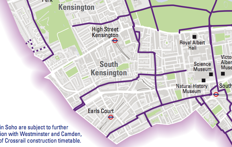
  • It confirms that plans for Superhighway 9 have focussed on the issues of Kensington High Street
  • When the cycle vision was launched it was assumed by Andrew Gilligan that Superhighway 9 would not go ahead due to RBKC’s lack of support
  • In the cycle vision as presented to RBKC the only superhighway into the West of London was cycle crossrail up on the Westway
  • Kensington and Chelsea’s original objection to the superhighway was to blue paint on aesthetic grounds
  • It was presumed without creating mockups that Kensington and Chelsea would object to segregation
  • Mockups were then created both of segregation on Kensington High Road and of cycling in Holland Park to try and get these features onto the Central London Grid
  • It was felt by RBKC that a quietway route using Holland Park and Holland Road would be a viable alternative but it also failed to make it onto the Central London Grid
An example of segregation that could be used on Kensington High Street - at risk due to the council objecting
An example of segregation that could be used on Kensington High Street – at risk due to the council objecting

We continue to await details from TfL to get their side of the conversation but it is plain that Kensington and Chelsea are not fully on board with the Mayor’s Cycling Vision and are not interested in any large scale changes to their roads. In their own words “The Central London Grid will not mean any significant interventions and certainly no segregation on RBKC roads” – in which case, what is it for? As such, we are now even more sceptical of their commitment to the Central London Grid and even though there are clearly efforts in here to create a route using Holland Road and making better crossings even in this correspondence it is admitted that it is highly likely to have at least one dismount section even without Holland Park not permitting through cycling.

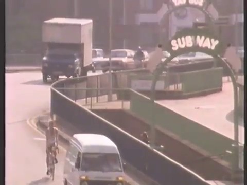
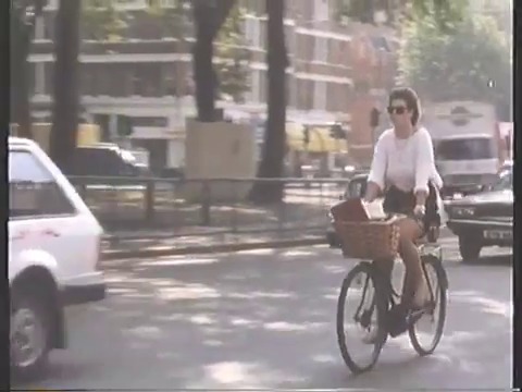
We stand by our comments on the Central London Grid, that it is vital to make an intervention on the main roads in West London, as by RBKC’s own words on Kensington High Street “there are no continuous alternative east-west routes nearby”. It is very disappointing that segregation is being blocked without so much as a consultation or open conversation with the people who ride upon it and their own numbers are being used as justification not to segregate. This is not thinking that will lead to an improvement in conditions on the roads or a further reduction in collisions in the streets of Kensington and Chelsea. It should be remembered that Kensington High Street is very effectively paralleled as an East-West route by the A4 which provides a much greater capacity and safety for motor vehicles than anything presented to vulnerable road users in the area.

For history on the earlier stages of Superhighway 9, please see our page on the earlier shared designs. We will work hard to uncover more details of what would have happened with Superhighway 9 were it built, should the cancellation of it as a route from Hammersmith into London via Kensington and Chelsea now be confirmed. This could well be in the coming days.

Hammersmith Broadway, funded for change

On Wednesday last week the Mayor of London’s office issued an announcement of the 33 junction across London which were to share in major funding to make them safe for cyclists. This had been widely trailed, to the extent that Andrew Gilligan, cycling commissioner had specifically said Hammersmith Broadway was on the list in December.

The section concerning Hammersmith was a single paragraph:

At other intimidating gyratories, such as Hammersmith and Vauxhall, safe and direct segregated cycle tracks will be installed, pending more radical transformations of these areas in the medium term.

This is still not a full announcement but we now know the following things. The junction review for major infrastructural changes for cycling will now focus on only 33 junctions rather 100. Of the original 100 list only one was in Hammersmith and Fulham, which was Talgarth Road / Gliddon Road on the A4 by Baron’s Court. The new plans share about £290m between 33 junctions or an average of £9m per scheme. These should not be small changes. Actual funding will vary by scheme but it is fair for us to have strong expectations of the changes for Hammersmith Broadway. TfL’s own comments are explicitly talking of segregation. It also sounds likely given the phrasing that Hammersmith is in an initial set of 10 junctions where there will be changes by 2016.

Of our neighbouring boroughs, Hounslow has a pair of junctions at Kew Bridge and Chiswick Roundabout carried over from the 100 junction list, and Wandsworth have the town centre in Wandsworth up for review. Kensington and Chelsea have no major junction in this scheme, so no improvements here for Earl’s Court or their side of Holland Park Roundabout for example. With the demise of Superhighway 9 looking almost certain to be confirmed that also means junctions such as at Olympia where Hammersmith Road/Kensington High Street cross the A3220 on Holland Road / Warwick Road and Addison Road/Warwick Gardens may linger without change for some time.

Therefore we cautiously welcome this development, as it does sound like the right level of investment and scale of change necessary to change Hammersmith Broadway.  It should help reduce the collisions that continue to take place there and also unlock cycling as an option for many more in the borough and beyond by removing a key barrier to cycling. We look forward to seeing proposals and hope they do deliver a step change, using segregation to permit 8-80 cycling through this crucial junction. Our key concern is to see how these changes on the Broadway can deal well with approaching roads and help deliver real changes to the cycling environment and town centre of Hammersmith in the coming years ahead of any prospective Flyunder.

For the other key gyratories, junctions and roundabouts in the borough and beyond that need to be addressed, we shall continue to campaign. They range from the  pair at Shepherd’s Bush and Holland Park Roundabout to other junctions along the A4 and Westway to simpler T-junctions, crossroads and roundabouts.  The model of funding being adopted by TfL using major schemes and developer funding alongside cycle funding can be reused to help deal with these major junctions. We will start to make that case as part of our Space For Cycling campaign in the coming weeks.

We continue to study plans around the Flyunder and how in the longer term Hammersmith Broadway might return to two-way traffic and cease to be a gyratory. We hope to share more detail on this in the coming week.

Space For Cycling meeting on Monday 17th February 2014

Note, no formal minutes exist for this meeting (an audio recording was used to decide our asks but not retained). The final asks from this meeting are published on the site.

AGENDA for Space For Cycling meeting on Monday 17th February upstairs in local pub, Blue Anchor at 13, Lower Mall, Hammersmith, W6 9DJ from 6:30PM, starting just after 7PM.

Contact – Alex Ingram – 07717725120 – alex@hfcyclists.org.uk

6:30PM – start to arrive (remember, upstairs!)
7:00PM – kick off meeting with introductions
7:05PM – Space For Cycling – Shepherd’s Bush cluster and Hammersmith Cluster
8:00/8:15PM – break
by 8:30PM – Space For Cycling – Fulham Cluster
9:00PM – AOB

Details of asks by ward and maps of the clusters and asks now live on the website: http://hfcyclists.org.uk/2014/02/space-cycling-themes-colour-agenda-decide/

Note – this timetable is HUGELY pessimistic on our pace and we may find the process faster and more straightforward.

The key to the meeting is that we must come up with one ask for each ward in the borough. Some roads are on the boundaries of boroughs, additionally some wards (especially Hammersmith Broadway) have a lot of suggested ideas. In such wards we may find combining several ideas into a bigger ask the best solution. We should also discuss how we might create extra material (especially video) by the end of the month to support the asks. I’m quite happy to take charge of production of such pieces but I’m keen for extra ideas on how to make that work! And if anyone wants to feature in a video that is especially welcome.

Let me know if you’ve any queries and feel free to start to comment on the email list replying to this message as well. I know not everyone can make the meeting, but feedback ahead is especially welcome.

Cycling in Hammersmith and Fulham under the GLC

On YouTube a video has been uploaded originally made in 1984 to show progress made on cycling by the Greater London Council in coordination with boroughs. At the time the Greater London Council (GLC) had helped fund the beginnings of a cycling network and improve cycling throughout London. Much of the work took place in Hammersmith and Fulham. There are even animations (specially commissioned) which show how many of the early junctions in Hammersmith worked.

GIF Animation of crossing under Hammersmith Flyover
Animation of crossing under Hammersmith Flyover

Of particular note to us are absolutely amazing sections showing then new facilities at various parts of Hammersmith. Every facility has inevitably been reworked in the decades since and indeed some are actually even preserved in a form on Google Street View (which we’ve linked in captions below the images) that has only recently been further revamped. The point to note from all of this is that it does at least appear the borough have been capable of renewing and maintaining a cycle network if not extending it in the years since. These are just some that we’ve noticed, let us know if you spot any others.

Cyclist on Holland Park Roundabout, 1984
Cyclist on Holland Park Roundabout. Since then railings have gone, lights have changed but it’s still 4-5 lanes of traffic to navigate by bike  > see now on Street View
Quiet route paralleling Fulham Palace Road
Quiet route paralleling Fulham Palace Road, this continues to work fairly well though you’ll often see local school children riding on the pavement.  > see now on Street View
Crisp Road Contraflow
Crisp Road Contraflow, this has changed a lot as trees have grown and is constantly under threat due to nearby developments.  > see now on Street View
Addison Bridge avoiding Holland Park Roundabout
Addison Bridge avoiding Holland Park Roundabout, this is absurdly narrow. It has since had parking removed and has segregated lanes in either direction.  > see now on Street View
Bridge Road crossings under Hammersmith Flyover
Bridge Road crossings under Hammersmith Flyover, even in 1984 it was odd not to allow contraflow cycling coming towards the camera. Will we fix that after 30 years? > see now on Street View
Woman cycling around Shepherds Bush Green - lovely practical bike!
Woman cycling around Shepherds Bush Green – lovely practical bike. It’s more likely we’d see such a cyclist using the paths over the green which came in after this film. However, for many journeys cycling on the road is the most sensible option despite the risks. > see now on Street View
Then proposed links to enable cycling from Shepherds Bush Green into the main roads. These mostly survive but have been under threat in recent years and are not as complete as shown. Cycling on the green is now simpler shared use but with additional poorly executed paths around the edge. It is no safer today!

All this and more is in the video which is a very informative and fascinating 24 minutes or so of viewing. You’ll realise just how quickly changes can and were made back then, and of course how few changes have been made since. We note that most changes in Hammersmith and Fulham have been to the quality of these interventions but not to create that many more . The main thing sadly missing is the contraflow lane on Hammersmith King Street which followed some years later, just after the GLC was abolished by the Thatcher government.

The film ends with a comment which remains accurate even today, sadly: “If we are to create another generation of cyclists, we must plan London for them now.” On which note, don’t forget our Space For Cycling meeting is on Monday!

Some Research Of Our Own

Now beyond the material in the film we have also been doing research online, in libraries and in borough archives.

There is very little in newspapers of the time online (other than the Times archive) but that reveals that the GLC’s team in 1982 comprised 4 full-time and up to 36 part-time staff. It was found that changes in Fulham (probably the quiet route paralleling Fulham Palace Road) had increased cycling by 22%.

Screen Shot 2014-02-16 at 18.45.34

The plans of the time were advanced even in 1982 when the Times wrote (May 03, 1982; pg. 5; Issue 61223) of “cycle ways, possibly underground” being considered across London. This was happening during a time when public transport provision was being forced to be reduced in London and traffic on the streets was growing. Cycling was positioned by the GLC as an alternative (40% of those losing services were expected to walk or cycle, as opposed to 20% to drive).

Screen Shot 2014-02-16 at 18.45.43

The then new crossing into Hyde Park from Bayswater cost £85k (roughly £254k in cost today) of which the Ministry of Transport contributed £56k. Those were the first bicycle traffic lights in London, installed in 1982. It seems sad that we are only just seeing moves towards low level lights in London now.

eBay brought our coordinator a copy of an original map from around the time of this film for planning routes with the GLC. We’ve quickly scanned it in to share as it’s a timely reminder both of how long ago and how compromised past efforts were, but also shows where there are differences and similarities to the current Central London Grid proposal.

Hammersmith and Fulham GLC Cycle Map Early 80s
Hammersmith and Fulham GLC Cycle Map Early 80s – click for full size.

It is very interesting to compare this to the current (last revised in 2006) map of walking and cycling routes as available on the council website today. The basic grid was delivered with interventions at a few key places in the early 80s. Some routes have been added, some taken away. Though note that now the map is much more likely to include a road with a bus lane or even just cycles painted on the road. It is probably quite interesting to look at why certain roads were no longer considered part of the network. Cycling on main roads has become more accepted by the council, but interventions – other than segregated contraflows or bus lanes – have not.

Hammersmith and Fulham Walking and Cycling Map 2006
Hammersmith and Fulham Walking and Cycling Map 2006 – click for full size

You might ask how seriously are the borough taking cycling, when the biggest shopping centre in West London isn’t even on the local cycle map. And if you are inspired to campaign then you could help us work on Space For Cycling, come to our meeting on Monday 17th February or read over our comments on the Central London Grid and send your own response.

We’ll follow up in time with some period leaflets and other items we’ve found, though we welcome any contributions people have of memories and artefacts of cycling in London and our local area. Drop us a line by commenting below or email us.

London Cycle Grid – response from the West

We have earlier posted at length on the London Cycle Grid, here is our current proposed response which you are free to draw inspiration from. There have now also been responses from the Kensington and Chelsea group, on the London Cycle Campaign website and from Rachel Aldred which we reccomend you review. The deadline for the consultation is the 14th of February, but we’re not in love with what we’ve been given to respond to.

We are focussing our concerns on the lack of high quality East-West cycle routes. As we have shown already, there is much poorer linkage of the grid into West London than any other area. This appears to be the responsibility of the decisions made by Kensington and Chelsea in designing their section of the grid.

West London Combined Map

The grid linking into West London is shown above – as you can see the West London Line forms our Eastern boudnary and has very few good quality crossings for cyclists. Superhighway 9 would have provided a higher quality link on the main desire line. However, Superhighway 9 has not appeared on the Central London Grid, and is presumed to be cancelled. We find it simply deplorable that no-one has stood up and commented officially on its status before this consultation closes. The closest we have are the by now standard comments from Andrew Gilligan that:

On the dozen superhighway routes: as I’ve been saying for months, some of the routes proposed pre-Vision were on wholly unsuitable roads, or on roads where the local authority wasn’t comfortable with intervention to post-Vision standards. Those will be rerouted or cancelled, but there will be other entirely new routes to replace them. In other words, the number of routes will be (at least) the same, but they won’t be in the same places.

from the London Cycling Team Blog

We’re sorry Andrew, but it’s no comfort to cyclists who have issues with cycling on Hammersmith Road, Kensington High Street or Kensington Road that the 1 in a column for Superhighway 9 there is being added up somewhere else. More should be being done by the Mayor and TfL to examine how to make Kensington and Chelsea respond to the need for safer cycle routes in their streets. Encouraging people to cycle into London through a borough with no 20mph zones, no safe space for cycling on its main streets and the odd contraflow route here or there is not a viable strategy. It appears we are left to pray that the political will in Kensington and Chelsea – and it is that political choice, by the councillors of Kensington and Chelsea that is setting the agenda – changes.

With no clear indication of what happens. We must therefore consider out loud the possibilities:

If we take the grid as an indication, Superhighway 9 is gone and it is built somewhere else in London. There would therefore be no Superhighway between the Thames and the Westway. We count that there are at least 12,000 East-West cycle movements a day in this zone on main roads in official figures. That’s a lot of cyclists to try and focus onto 2-3 quiet road routes which don’t provide good mass cycling conditions.

Alternately it may be that Superhighway 9 is realigned along TfL roads rather than borough roads. This would presumably place it on the A4. This would link in somewhat with the proposed central london grid, but as Kensington and Chelsea’s feedback to their council has shown there are many gaps and round the houses routings in their grid which present serious issues.

Here is our response focussing on the issues we see most local to us.

[gview file=”http://hfcyclists.org.uk/wp/wp-content/uploads/2014/02/Final-hfcyclists-Cycle-Grid-Response.pdf”]

Hammersmith Grove – raised table

[osm_map lat=”51.498″ long=”-0.227″ zoom=”15″ width=”350″ height=”300″ marker=”51.49816,-0.22753″ marker_name=”bicycling.png” type=”CycleMap”]

We’ve received a brief proposal from Hammersmith and Fulham council for a raised table and the removal of an island in a zebra crossing on Hammersmith Grove. This is in response to problems with through vehicles – especially lengthy ones – regularly blocking this street. Though Hammersmith Grove is not a main road it is a designated C road and due to the configuration of nearby gyratories is used along with Trussley Road both for access to nearby homes and as a rat-run by many other motorists and taxis.

HammersmithGroveRaisedTableJan2014
This is the plan above from the council’s own PDF document.

Their accompanying letter has the following text

We propose to carry out highways improvements in Hammersmith Grove, between Amor Road and Trussley Road, following concerns raised by residents as well as observing frequent traffic conflicts along this section of road. Please see the plan overleaf.

As part of the proposal we will remove the existing traffic island at the zebra crossing to help facilitate traffic movements from Trussley Road. We will also raise the area in order to highlight the location of this crossing to approaching motorists and encourage lower speeds on their approach. We also plan to remove excessive and outdated street furniture around this location and plant more trees, in order to aesthetically improve this area and support the retail and restaurant environment. Some additional parking spaces will also be created.

We will aim to maintain access to the area throughout the works. Temporary diversions may be required during the works. Businesses and residents will be informed of any diversions in advance of them taking place.

We note the following issues:

  • This table will be placed on the main quiet road cycle route between Hammersmith and Brook Green (which avoids Shepherd’s Bush and Hammersmith gyratories). As such the route must be safe for small children who are often seen cycling through the area accompanied and it presents a barrier to some already. The ramps will be a particular problem for them.
  • This follows a recent consultation on a neighbourhood scheme on the other side of Trussley Road – a more rounded plan needs to be made about dealing with through traffic, rather than two disjoined schemes.
  • With the removal of the width restriction at the zebra crossing vehicle speeds may increase, at present the zebra island helps slow vehicles prior to the turn many vehicles perform to enter Trussley Road
  • Kerb heights vary from around 10-15cm in the area
  • The raised table is quite short and does not extend sufficiently into the side streets to be of use to pedestrians
  • Ramps are of varying length on the side and main streets. All have the same speed limit of 20mph, so surely need similar approaches
  • Car parking is being extended onto the ramps
  • There is no improvement to cycle parking in an area with a severe lack of it, this is a good location to experiment with cycle parking in the carriageway.

[gview file=”http://hfcyclists.org.uk/wp/wp-content/uploads/2014/02/hfcyclists-Hammersmith-Grove-Table.pdf”]